Abstract
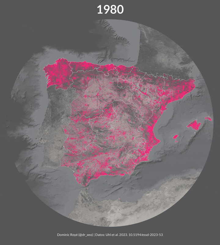
Multi-temporal measurements quantifying the changes to the Earth’s surface are critical for understanding many natural, anthropogenic, and social processes. Researchers typically use remotely sensed earth observation data to quantify and characterize such changes in land use and land cover (LULC). However, such data sources are limited in their availability prior to the 1980s. While an observational window of 40 to 50 years is sufficient to study most recent LULC changes, processes such as urbanization, land development, and the evolution of urban, and coupled nature-human systems often operate over longer time periods covering several decades or even centuries. Thus, to quantify and better understand such processes, alternative historical-geospatial data sources are required that extend farther back in time. However, such data are rare and processing is labor-intensive, often involving manual work. To overcome the resulting lack in quantitative knowledge of urban systems and the built environment prior to the 1980s, we leverage cadastral data with rich thematic property attribution, such as building usage and construction year. We scraped, harmonized, and processed over 12,000,000 building footprints including construction years to create a multi-faceted series of gridded surfaces, describing the evolution of human settlements in Spain from 1900 to 2020, at 100 m spatial and 5 years temporal resolution. These surfaces include measures of building density, built-up intensity, and built-up land use. We evaluated our data against a variety of data sources including remotely sensed human settlement data and land cover data, model-based historical land use depictions, as well as historical maps and historical aerial imagery, and find high levels of agreement. This new data product, the Historical Settlement Data Compilation for Spain (HISDAC-ES), is publicly available (https://doi.org/10.6084/m9.figshare.22009643; Uhl et al., 2023a) and represents a rich source for quantitative, long-term analyses of the built environment and related processes over large spatial and temporal extents and at fine resolutions.